How To Combine Quizzes

You can now create super quizzes in our flag and language games by combining questions from multiple pages using the load= parameter in the URL.

How it works:
Add ?load= followed by quiz IDs (separated by commas) to combine them with your current quiz.

Examples:
https://ekvis.com/en/esani02/?load=esani01 – Combines esani02 + esani01
https://ekvis.com/en/esani02/?load=esani01,esbod01 – Combines esani02 + esani01 + esbod01

You can now bookmark the new page or send the url to other players.

The id to use in the load= string comes from the url of the pages. In the url: https://ekvis.com/en/esani02/ the id is the part after en/, so esani02. If you want to add those questions to another quiz, go to the other quiz and add ?load=esani02 to that url

If you want to combine more than two quizzes, use , between the id and no spaces in the list ?load=esani01,esani02

To get a random sample, add all quizzes you want to select from with the load parameter, then limit the length of the quiz with the parameter max by adding &max=(number of questions in the new quiz)

Note that after the last id in the load section, there needs to be an & (ampersand) character before the max=10 or what length you prefer on the new quiz. Example: https://ekvis.com/en/esani02/?load=esani01,esbod01&max=8

Will Iran Change Its Flag?

Iran’s current national flag, adopted in 1980 after the Islamic Revolution, features a green-white-red tricolor with a stylized “Allah” emblem and “Allahu Akbar” repeated 22 times. It replaced the historic Lion and Sun flag used under the Pahlavi monarchy.

The current official flag of Iran

Since late 2025, massive protests have revived the Lion and Sun symbol as a powerful sign of opposition. Demonstrators have burned or torn down the official flag, raised the pre-1979 version in cities across Iran, and replaced it at embassies abroad (e.g., London in January 2026). Diaspora rallies worldwide show the same emblem, often alongside calls for regime change.

The Lion and Sun flag.

In a notable digital gesture, X (formerly Twitter) updated its Iran flag emoji to a modern Lion and Sun design in January 2026, amplifying the symbol globally—even on Iranian state-linked accounts.

As of March 2, 2026, no official change is happening. The regime, despite Supreme Leader Khamenei’s death on February 28, 2026, in U.S.-Israeli strikes, still flies its flag and views the Lion and Sun as a direct threat to its identity.

A flag of Iran with a lion at a diaspora rally

A formal redesign would require regime collapse or major reform, which is possible amid the ongoing unrest, but uncertain. Opposition groups disagree: some want the Lion and Sun restored, others a completely new design.

For now, two flags coexist: the official one on government buildings, and the Lion and Sun in protesters’ hands and on screens worldwide. The real change has already begun symbolically. The official one depends on Iran’s political future.

Countries Not Recognized by the UN

The United Nations (UN) has 193 member states. In addition, two entities — the Holy See (Vatican City) and the State of Palestine — have observer state status. When people refer to “countries not recognized by the UN,” they usually mean territories that function as independent states in practice (de facto states) but are not UN members and lack broad international recognition.

Taiwan

Taiwan operates as a self-governing state with its own government, military, currency, and elections. However, it is not a UN member. In 1971, the UN recognized the People’s Republic of China as the sole representative of China. Since then, Taiwan has been excluded from UN membership.

Kosovo

Kosovo declared independence from Serbia in 2008. It is recognized by more than 100 UN member states, but not by Serbia and several other countries. Due to opposition in the UN Security Council, Kosovo has not been admitted to the UN.

Western Sahara

Western Sahara is claimed by Morocco and partially controlled by the Sahrawi Arab Democratic Republic. The UN lists it as a non-self-governing territory, and its final status remains unresolved.

Northern Cyprus

Northern Cyprus declared independence in 1983. It is recognized only by Turkey. The international community generally considers it part of the Republic of Cyprus.

Somaliland

Somaliland declared independence from Somalia in 1991. It has its own government, military, and currency, but it is not recognized as an independent state by the UN or any UN member state.

Other Partially Recognized or De Facto States

Additional examples include Abkhazia, South Ossetia, Transnistria, and (until 2023) Artsakh. Levels of recognition vary significantly between these territories.

Why Recognition Matters

UN membership confirms broad international recognition and allows participation in the UN General Assembly and other international institutions. Admission requires approval by the UN Security Council, where permanent members hold veto power. As a result, geopolitical considerations often influence recognition decisions.

Equatorial Guinea Changes Its Capital

Equatorial Guinea is a small country in Central Africa. For many years, its capital city has been Malabo, which is located on an island called Bioko. However, the government has decided to move the capital to a new city on the mainland.

The new capital is called Ciudad de la Paz. It was previously known as Oyala. This city is located in the mainland part of the country, known as Río Muni. The new capital was announced in Januari 2026.

One reason for the move is geography. Most of Equatorial Guinea’s land area and population are on the mainland, not on the island where Malabo is located. By moving the capital, the government says it will be easier to manage the country and connect different regions.

Ciudad de la Paz is a planned city. This means it was designed in advance, with wide roads, government buildings, and space for future development. Many important government institutions have already started moving there, but Malabo is still used for some official purposes.

The change of capital is a gradual process. It takes many years to move ministries, offices, and workers. Because of this, some people still think of Malabo as the capital, even though the government has officially named Ciudad de la Paz as the new one.

“Ciudad de la Paz” means “the City of Peace” in Spanish. Equatorial Guinea is the only Spanish-speaking country in Africa.

Är Somaliland ett land?

Somaliland är en självutropad självständig region i norra Somalia. Det utropade sin självständighet från Somalia 1991, efter Somalias centrala regerings kollaps.

Hargeisa är Somalilands huvudstad.

Somaliland har en egen regering, militär, valuta och konstitution. Det håller val och fungerar separat från Somalias federala regering, som det inte erkänner som att ha någon auktoritet över sitt territorium.

Under många år erkände inget land officiellt Somaliland som självständigt, och Förenta nationerna fortsatte att betrakta området som en del av Somalia. I december 2025 blev dock Israel det första landet som formellt erkände Somaliland som en självständig stat, vilket markerade en stor förändring av dess internationella status.

Många invånare i Somaliland identifierar sig starkt med regionens självständighet och pekar på dess relativa stabilitet jämfört med stora delar av Somalia. Förespråkare menar att ett erkännande speglar verkligheten på marken. Samtidigt har den långvariga bristen på erkännande begränsat Somalilands tillgång till utländskt bistånd, investeringar och formella diplomatiska relationer.

Huruvida Somaliland betraktas som ett land beror på hur statsskap definieras. Det uppfyller många praktiska kriterier för att vara en stat, men de flesta länder i världen har inte formellt erkänt det. Även med Israels erkännande förblir Somalilands status en av världens olösta geopolitiska frågor.

För att lära dig mer om Somalia och Afrika, prova gärna våra geografispel, till exempel om Afrikas länder.

Somaliland map

Israel Becomes the First Country to Recognize Somaliland

Somaliland map
Map of Somaliland

In a historic decision on December 26, 2025, Israel became the first country in the world to officially recognize Somaliland as an independent country. This is a major moment because Somaliland had been trying to get global recognition for more than 30 years.

🗺️ What Is Somaliland?

Somaliland is a region in the Horn of Africa that used to be part of Somalia. It declared itself independent in 1991 after a long civil war in Somalia. Since then, it has run its own government, money, and security, but most countries in the world did not recognise it as a separate country — until now.

🤝 What Did Israel Do?

Israel and Somaliland signed an agreement that makes their relationship official. This means they will:

  • Exchange ambassadors
  • Open embassies
  • Work together on things like agriculture, technology, health, and the economy

The Israeli Prime Minister, Benjamin Netanyahu, called it a big step forward and said it fits with earlier peace deals known as the Abraham Accords — agreements that brought Israel closer to several countries in the Middle East.

🌍 Why Is This Important?

This matters for a few reasons:

  1. Strategic Location: Somaliland sits near important sea routes by the Red Sea and Gulf of Aden. These waters connect Europe, Africa, and Asia, so countries care a lot about security there.
  2. Regional Reactions: Some neighboring countries, like Egypt, Turkey, and Somalia, strongly criticized the decision. They say it could harm peace and go against international rules.

🤔 So What Happens Now?

Somaliland and Israel will start working more closely together. Other countries will be watching to see if they also decide to recognise Somaliland. But for now, this is a very rare and historic moment — one that could change relations in Africa and the Middle East

What Is The Greater Idaho Movement?

The Greater Idaho Movement is a political idea in the United States that aims to change the border between two states: Oregon and Idaho. Supporters want a large part of eastern Oregon to leave Oregon and instead become part of Idaho. The goal is to create a new, bigger Idaho—hence the name “Greater Idaho.”

Where the idea comes from

Oregon is divided by culture and politics. The western part of the state, where most people live (in cities like Portland and Eugene), tends to vote for liberal or progressive policies. The eastern part of the state is much more rural and conservative. Many people there feel that the state government in Portland does not represent their values or priorities.

Because of this, some local groups in eastern Oregon began promoting the idea of joining Idaho, which has a more conservative government. They believe Idaho’s laws on issues like taxes, guns, and environmental rules fit their views better.

As of July 2024, thirteen counties in Oregon (shown in red) had approved ballot measures in favor of Greater Idaho.

What supporters want

The Greater Idaho movement does not want to create a new state. Instead, it wants to move the existing border so that about 15 counties from eastern Oregon would officially become part of Idaho. That would give Idaho more land and population, while western Oregon would become smaller.

Supporters say this would:

  • Give people in eastern Oregon a government that matches their values.
  • Make local communities feel more represented.
  • Reduce tension between rural and urban areas.

What critics say

Opponents argue that changing state borders is not practical. They point out that:

  • Both the Oregon and Idaho legislatures would have to agree to the change.
  • The U.S. Congress would also have to approve it.
  • The process would be long, expensive, and extremely unlikely to succeed.

Critics also say that dividing the state further would not solve the real problems—such as economic inequality, rural decline, and lack of communication between different political groups.

What has happened so far

Since 2020, several eastern Oregon counties have held local votes on whether they support exploring the idea of joining Idaho. Most of those counties voted “yes,” but these votes are only symbolic. They do not have any legal power to move the border.

Some Idaho politicians have said they are open to talking about it, but the Oregon government has not shown interest. For now, the movement remains mostly a political statement rather than a real plan.

Why it matters

Even though the border is unlikely to change, the Greater Idaho Movement shows how divided U.S. politics can be between cities and rural areas. Many people across the country feel disconnected from state or federal governments, and this idea reflects that frustration.

Learn more about Idaho by playing or map quiz game: https://ekvis.com/en/g-us-id/

Possible Geopolitical Changes in 2026

The world map has stayed mostly the same for decades, with countries keeping their borders even during big conflicts. But in 2026, some ongoing disputes could lead to changes in who controls certain territories. These aren’t guaranteed—geopolitics is unpredictable—but experts are watching a few hot spots closely.

Russia and Ukraine

The war between Russia and Ukraine continues to affect Europe’s borders. Russia currently controls parts of eastern and southern Ukraine, including Crimea, which it took in 2014. Most countries still recognize these areas as Ukrainian territory.

By 2026, the front lines could change again, depending on how the war develops. If Ukraine retakes more land, its borders could move back toward how they looked before 2022. If Russia keeps control, those borders might remain frozen, even if the rest of the world refuses to accept them as official. Kyiv will remain the capital of Ukraine.

Bougainville

Bougainville is an island region that belongs to Papua New Guinea. In a 2019 referendum, almost everyone there voted to become independent. Since then, leaders from Bougainville and Papua New Guinea have been negotiating how and when that independence might happen.

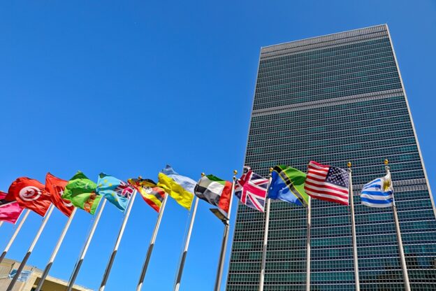
If all goes according to plan, Bougainville could become a new country around 2026 or 2027. The capital would probably be either Buka or Arawa. If independence happens, Bougainville would be the first new country recognized by the United Nations since South Sudan in 2011.

New Caledonia

New Caledonia is a group of islands in the Pacific that is currently part of France. It already has some self-rule but will hold another vote in 2026 to decide its future. Voters can choose between remaining part of France with more autonomy or moving toward full independence. Nouméa would remain the capital in either case. The result of this vote could shape the islands’ future for decades.

Kosovo and Serbia

Kosovo declared independence from Serbia in 2008, but Serbia has never accepted it. Over the years, some politicians have discussed a possible land swap to settle the dispute—giving Serbia control of some Serb-majority areas in northern Kosovo and Kosovo control of Albanian-majority areas in southern Serbia.

No agreement has been reached, but international talks may continue in 2026. If a deal were made, it would be one of the first official border changes in Europe in many years.

Greenland

Greenland is part of the Kingdom of Denmark but has its own parliament and government. It aims to become fully independent in the future. That will not happen in 2026, but Greenland might take more steps toward self-government. Nuuk will stay the capital, and independence could still be several years away.

Taiwan and China

China sees Taiwan as part of its territory and has not ruled out force to unify. Taiwan functions as an independent democracy. Experts watch for increased pressure like military exercises, but a full invasion is considered low probability in 2026. No border change is expected soon.

Greater Idaho

In the United States, some people in eastern Oregon want their region to become part of Idaho. A few local votes have supported this idea, but changing state borders is very difficult. Both state legislatures and the U.S. Congress would have to approve, which makes it very unlikely to happen anytime soon.

OpenStreetMap: The Free, Editable Map of the World

OpenStreetMap, often abbreviated as OSM, is a collaborative project that aims to create a free, editable map of the entire world. It was founded in 2004 by Steve Coast in the United Kingdom, inspired by the success of open-source software such as Wikipedia. Unlike proprietary map services, OpenStreetMap’s data is freely available for anyone to use, modify, and distribute.

Part of Luxembourg in Open Streetmap

How It Works

OpenStreetMap relies on contributions from a large community of volunteers known as “mappers.” These contributors use GPS devices, aerial imagery, and local knowledge to add and update map data. Everything from roads, rivers, and railways to shops, hiking trails, and bicycle paths can be mapped. The data is stored in a central database and continuously improved by users worldwide.

Open Data for Everyone

All OSM data is released under the Open Database License (ODbL). This means it can be freely used by individuals, companies, and governments as long as credit is given to OpenStreetMap and its contributors. Many organizations use OSM data as the foundation for mapping applications, humanitarian efforts, and research projects.

Humanitarian Mapping

One of the most significant uses of OpenStreetMap is in disaster response and humanitarian aid. The Humanitarian OpenStreetMap Team (HOT) coordinates volunteers who rapidly map affected areas after natural disasters such as earthquakes, floods, or hurricanes. These maps help relief agencies navigate and plan their operations in regions where up-to-date commercial maps are often unavailable.

Global Collaboration

OpenStreetMap is a truly global community project. Thousands of people around the world contribute daily, adding new information, correcting errors, and enhancing details. Local mapping events, known as “mapathons,” bring together volunteers who work together to improve specific areas. The result is a constantly evolving, high-quality map that reflects the real world more accurately than many commercial alternatives.

OpenStreetMap Europe

Iran Considers Moving Its Capital from Tehran

Since 2010, Iran’s government has considered relocating the national capital away from Tehran. The reasons include severe air pollution, traffic congestion, overpopulation, and the high risk of earthquakes. Tehran has grown rapidly and now has over 13 million residents in its metropolitan area.

Skyline of Tehran with Milad tower at sunset.

The issue returned to the spotlight in 2025, when President Ebrahim Raisi stated in October that a relocation is necessary due to worsening water shortages and Tehran’s overstretched infrastructure. His statement marked increased political pressure to act after years of stalled debate.

The proposal was formally endorsed by the Iranian parliament in 2010, and a council was established to explore alternatives. The plan could involve transferring governmental functions to another city, while Tehran would remain the country’s economic center. Similar arrangements exist in other countries, such as South Africa and the Netherlands.

Cities such as Isfahan, Qom, and Semnan have been mentioned as potential new capitals. So far, however, no concrete move has taken place, largely due to economic and administrative obstacles. Still, the crisis of 2025 may prove to be a turning point in the long-running discussion.