Is Somaliland A Country?

Somaliland is a self-declared independent region in the north of Somalia. It declared independence from Somalia in 1991, following the collapse of Somalia’s central government.
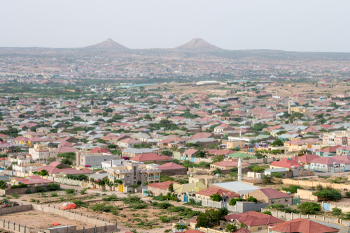
Hargeisa, the capital of Somaliland

Somaliland has its own government, military, currency, and constitution. It holds elections and operates separately from the Federal Government of Somalia, which it does not recognize as having authority over its territory.

For many years, no country officially recognized Somaliland as independent, and the United Nations continued to treat it as part of Somalia. However, in December 2025, Israel became the first country to formally recognize Somaliland as an independent state, marking a major change in its international status.

Many residents of Somaliland strongly identify with their region’s independence and point to its relative stability compared to much of Somalia. Supporters argue that recognition reflects the reality on the ground. At the same time, the long lack of recognition has limited Somaliland’s access to foreign aid, investment, and formal diplomatic relations.

Whether Somaliland is considered a country depends on how statehood is defined. It meets many practical criteria for being a state, but most of the world has not formally recognized it. Even with Israel’s recognition, Somaliland’s status remains one of the world’s unresolved geopolitical questions.
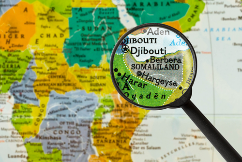
Somaliland on a map

What happened to Yugoslavia?

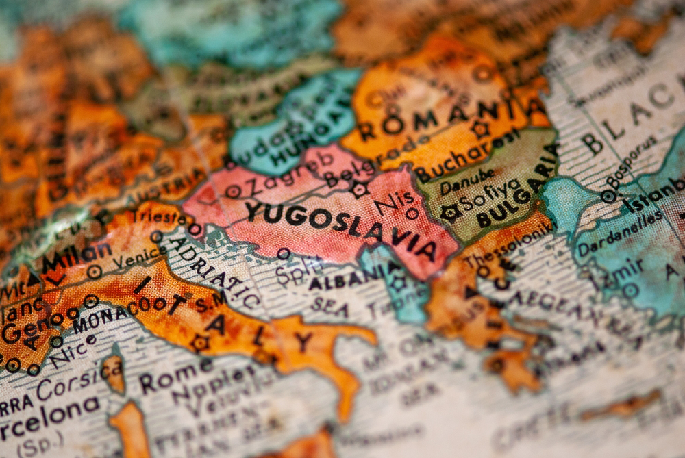
Yugoslavia was a country in Southeast Europe that existed in various forms throughout the 20th century. It was formed after World War I in 1918 as the Kingdom of Serbs, Croats and Slovenes, later renamed the Kingdom of Yugoslavia in 1929.

After World War II, Yugoslavia became a socialist federation led by Josip Broz Tito. It consisted of six republics: Slovenia, Croatia, Bosnia and Herzegovina, Montenegro, Macedonia, and Serbia. Serbia also included two autonomous provinces: Kosovo and Vojvodina.

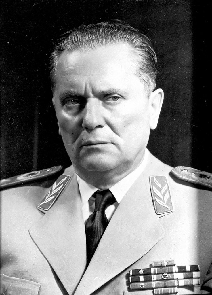
Josip Broz Tito

Yugoslavia remained relatively stable during Tito’s rule, but after his death in 1980, ethnic tensions grew. In the early 1990s, several republics declared independence, leading to a series of conflicts known as the Yugoslav Wars.

By 1992, Slovenia, Croatia, Bosnia and Herzegovina, and Macedonia had all become independent. What remained was called the Federal Republic of Yugoslavia, made up of Serbia and Montenegro.

In 2003, this was renamed Serbia and Montenegro. Finally, in 2006, Montenegro voted for independence, and Serbia became a separate country. Kosovo declared independence from Serbia in 2008, though it is not recognized by all countries.

Today, the territory of the former Yugoslavia consists of seven independent countries: Slovenia, Croatia, Bosnia and Herzegovina, Montenegro, North Macedonia, Serbia, and Kosovo.

The Relocation of Indonesia’s Capital: From Jakarta to Nusantara

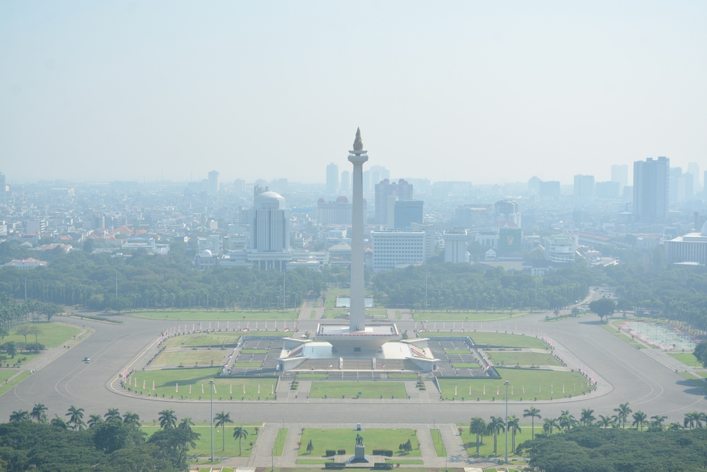
Smog in Jakarta

Indonesia is in the process of relocating its capital from Jakarta to a newly planned city called Nusantara. This decision was made due to Jakarta’s overpopulation, environmental challenges, and economic considerations. The relocation marks one of the most ambitious infrastructure projects in Indonesia’s history.

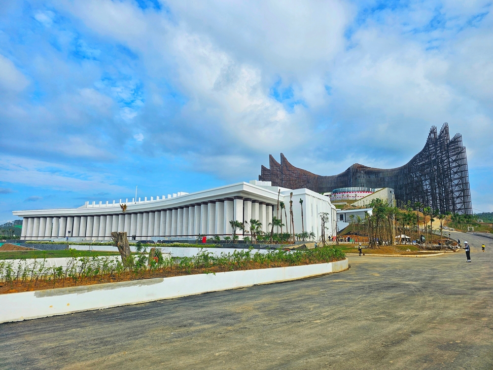
Nusantara presidental palace

Reasons for Moving the Capital

Jakarta, located on the island of Java, has long served as Indonesia’s capital. However, the city faces multiple challenges that prompted the government to consider a relocation:

  • Severe Overpopulation: Jakarta is home to over 10 million people, with the greater metropolitan area exceeding 30 million. This has led to chronic traffic congestion and urban crowding.
  • Environmental Concerns: Jakarta is sinking due to excessive groundwater extraction. Parts of the city are subsiding by as much as 25 cm per year, increasing the risk of severe flooding.
  • Economic Imbalance: Java dominates Indonesia’s economy, while other islands remain underdeveloped. Moving the capital is intended to promote economic growth in other regions.

Choosing Nusantara

In 2019, President Joko Widodo announced plans to relocate the capital to East Kalimantan, on the island of Borneo. The new city, named Nusantara, was chosen for its central location, lower population density, and reduced environmental risks.

Construction and Development

The construction of Nusantara officially began in 2022, with plans to complete the first phase by 2024. The key aspects of the development include:

  • Green and Smart City: Nusantara is designed to be environmentally sustainable, using renewable energy and smart infrastructure.
  • Decentralization: The move is expected to distribute economic opportunities beyond Java.
  • Government Relocation: Key government institutions, including the presidential office, are set to move to Nusantara.

Challenges and Criticism

Despite the ambitious plans, the relocation faces several challenges:

  • High Costs: The estimated cost of building Nusantara is around $32 billion, requiring significant investment.
  • Environmental Concerns: Although intended as a sustainable city, some fear that development in Borneo could lead to deforestation and harm biodiversity.
  • Logistical Issues: Moving government offices and infrastructure from Jakarta to Nusantara is a complex and time-consuming process.

Conclusion

Indonesia’s decision to relocate its capital from Jakarta to Nusantara is a historic move aimed at addressing overpopulation, environmental risks, and economic imbalance. While the project presents significant opportunities, it also comes with financial and environmental challenges. The success of Nusantara will depend on careful planning and execution in the coming years.

The Name Changes of Astana: A Capital in Flux

Astana, the capital of Kazakhstan, has undergone multiple name changes throughout its history. These changes reflect political transitions, national identity shifts, and the influence of Kazakhstan’s leadership. Below is an overview of the city’s historical names and the reasons behind each change.

Akmolinsk (1830–1961)

The settlement was founded in 1830 as a Russian military outpost and was named Akmolinsk. The name derives from “Ak-Mola,” meaning “White Shrine” or “Holy Place” in Kazakh, possibly referring to a local burial site or geographical feature.

Tselinograd (1961–1992)

During the Soviet Union’s Virgin Lands Campaign, aimed at increasing agricultural production in northern Kazakhstan, the city was renamed Tselinograd (from the Russian “Tselina,” meaning “virgin lands”). This renaming emphasized the city’s role in the large-scale Soviet agricultural project.

Akmola (1992–1998)

After Kazakhstan gained independence in 1991, the government sought to restore Kazakh identity to place names. In 1992, the city reverted to a variation of its original name, Akmola, aligning with the country’s move away from Soviet-era names.

Astana (1998–2019)

In 1997, Kazakhstan’s capital was moved from Almaty to Akmola, primarily due to Almaty’s geographic limitations and earthquake risk. In 1998, the city was renamed Astana, which simply means “capital” in Kazakh. The name was chosen to avoid favoring any particular historical figure or political ideology.

Nur-Sultan (2019–2022)

In 2019, after the resignation of Kazakhstan’s long-time president Nursultan Nazarbayev, his successor, Kassym-Jomart Tokayev, proposed renaming Astana to Nur-Sultan in his honor. This change was quickly approved, marking the city’s most politically motivated renaming. However, it faced public opposition, as many residents preferred the neutral name “Astana.”

Return to Astana (2022–Present)

In September 2022, following public dissatisfaction and political shifts, President Tokayev signed a decree restoring the city’s name to Astana. This decision was part of a broader effort to distance the country from excessive political leader worship and to reflect the population’s preference.

Conclusion

Astana’s name changes mirror Kazakhstan’s historical and political transformations. From its early days as Akmolinsk to the present, each renaming reflects a shift in national priorities, governance, and public sentiment. Whether the name remains “Astana” or changes again in the future remains an open question, but the city’s evolving identity will continue to be closely tied to the nation’s political landscape.

Landsting, region och län – vad är skillnaden?

Har du någon gång hört orden landsting, region och län och undrat vad de egentligen betyder? De låter ganska lika, men de har olika funktioner i Sverige. Låt oss reda ut begreppen!

Vad är ett län?

Ett län är ett geografiskt område, ungefär som en jättestor kommun. Sverige är indelat i 21 län, och varje län har en länsstyrelse som sköter sådant som staten ansvarar för, till exempel miljö, djurskydd och krisberedskap.

I varje län finns också en landshövding, som är regeringens representant där.

Vad är ett landsting?

Förr fanns något som hette landsting, som var en politisk organisation som styrde sjukvård och kollektivtrafik i varje län. Landstingen hade valda politiker och fungerade lite som kommuner, fast på en större nivå.

Men år 2019 försvann landstingen – och istället började vi kalla dem regioner.

Vad är en region?

En region är i stort sett samma sak som det gamla landstinget, men med ett nytt namn och lite fler uppgifter. Det är fortfarande regionerna som ansvarar för:

  • Sjukvård (sjukhus, vårdcentraler, ambulans)
  • Kollektivtrafik (bussar och tåg mellan städer)
  • Kultur och regional utveckling (hjälpa företag och turism i området)

Det finns 21 regioner – och de har samma gränser som länen.

Så hur hänger allt ihop?

  • Länet är det geografiska området. Staten styr där genom länsstyrelsen och landshövdingen.
  • Regionen (tidigare landstinget) styr sjukvård, kollektivtrafik och annat som rör människor i området.
  • Landsting används inte längre – det är bara ett gammalt namn för regionerna.

Sammanfattning

  • Sverige har 21 län – de är geografiska områden där staten styr genom länsstyrelsen.
  • Förr fanns landsting som styrde sjukvård och kollektivtrafik, men de heter nu regioner.
  • Regionerna har samma gränser som länen och styr över sjukvård, kollektivtrafik och utveckling i området.

Så, nästa gång du hör orden län och region, vet du exakt vad de betyder och hur de hänger ihop! 🎯

Lär dig ALLA SVERIGES LANDSKAP på 10 minuter!

Tvåfaldige minnesvärldsmästaren Jonas von Essen visar hur du med hjälp av minnestekniker snabbt kan lära dig precis var alla Sveriges 25 landskap ligger och hur de ser ut!

Jonas von Essen är en svensk minnesmästare och författare, känd för att ha vunnit VM i minne två gånger. Han specialiserar sig på avancerade minnestekniker, som inkluderar den så kallade loci-metoden (“minnespalatset”), där man visualiserar platser och kopplar information till dessa för att förenkla inlärning och memorering. Von Essen använder även associationsmetoder, där siffror och abstrakta data omvandlas till konkreta bilder och berättelser. Han har gett ut böcker och håller föreläsningar om minnesträning och hur hjärnan bäst lagrar och återkallar information.

Förslag om sammanslagning av län i Sverige

Under de senaste decennierna har det funnits flera förslag och utredningar om att slå samman Sveriges län. Syftet har oftast varit att effektivisera den offentliga förvaltningen, minska byråkrati och skapa starkare regioner.

Historisk bakgrund

Sveriges nuvarande länsindelning har sitt ursprung från 1600-talet, men har genomgått flera förändringar. En större reform skedde 1997 då Kristianstads och Malmöhus län slogs ihop till Skåne län, samtidigt som Göteborgs och Bohus län, Älvsborgs län och Skaraborgs län blev Västra Götalands län.

Förslag på storregioner

I början av 2000-talet började diskussioner om att ytterligare minska antalet län och skapa större regioner. En statlig utredning föreslog att de 21 länen skulle ersättas av sex storregioner, exempelvis en sammanslagning av Västerbotten, Norrbotten, Jämtland och Västernorrland till en Norrlandsregion. Liknande planer fanns för Götaland och Svealand.

Motstånd och nedlagda planer

Regeringen Löfven planerade en regionreform med målet att införa storregioner till 2019. Dock mötte förslaget kraftigt motstånd, särskilt i Norrland, där flera kommuner ansåg att en större region skulle leda till maktkoncentration i vissa städer. 2017 lades planerna ner, och år 2025 består dagens länsindelning fortfarande.

Framtiden

Trots att den senaste reformen stoppades diskuteras frågan fortfarande. Kritiker menar att dagens länsstruktur är ineffektiv och att större enheter behövs för bättre planering och ekonomi. Andra anser att lokalt inflytande försvagas vid sammanslagningar.

Om en framtida reform blir aktuell beror på politisk vilja och hur Sveriges regioner utvecklas ekonomiskt och demografiskt.

What Is An Exonym?

An exonym is a name used in one language or culture to refer to a geographic location (a city, country, region, or natural feature) situated within a different language area or cultural context. In other words, it is how people outside a place name it, rather than the name used locally by the inhabitants themselves.

For example, in English we say “Germany” for what Germans call “Deutschland,” and “Florence” for the Italian city known locally as “Firenze.” Those English names are exonyms. Meanwhile, the endonym (or autonym) is the name in the region’s own language—like “Deutschland” or “Firenze” in those two examples.

Exonyms arise for several reasons. Sometimes they reflect older historical names carried through centuries of trade and travel. In other cases, they are the result of different sounds and spelling conventions in the adopting language. While exonyms can provide familiarity and ease of pronunciation for speakers of a particular language, modern usage trends may lean more toward using local (endonymic) spellings or pronunciations, especially when respect for cultural or linguistic identity is a priority.

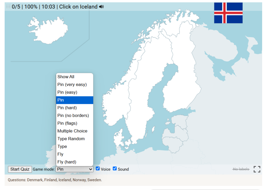
Game Modes

Our geography games on the Ekvis website offer a variety of game modes. Use the dropdown below the map to select a different mode and explore new challenges!

Show All: A learning mode where all locations are displayed on the map, allowing you to study and familiarize yourself with them.

Pin: Click on the exact location you’re prompted to find.

Pin (easy): Similar to ‘Pin,’ but three possible areas are highlighted, making it easier to choose the correct one.

Pin (very easy): Similar to ‘Pin,’ but as you hover over locations, their names are displayed to assist you.

Pin (no borders): Similar to ‘pin’, but the borders between countries are not visible, making the game a lot more challenging! (This is not available in city quizzes).

Muitiple Choice: Choose between four alternative names.

Type random: Type the names in any order, and they will be highlighted on the map as you go.

Type: Type the name of the highlighted country.

Fly: Use the arrow keys or WASD to steer, and press the spacebar for a speed boost.

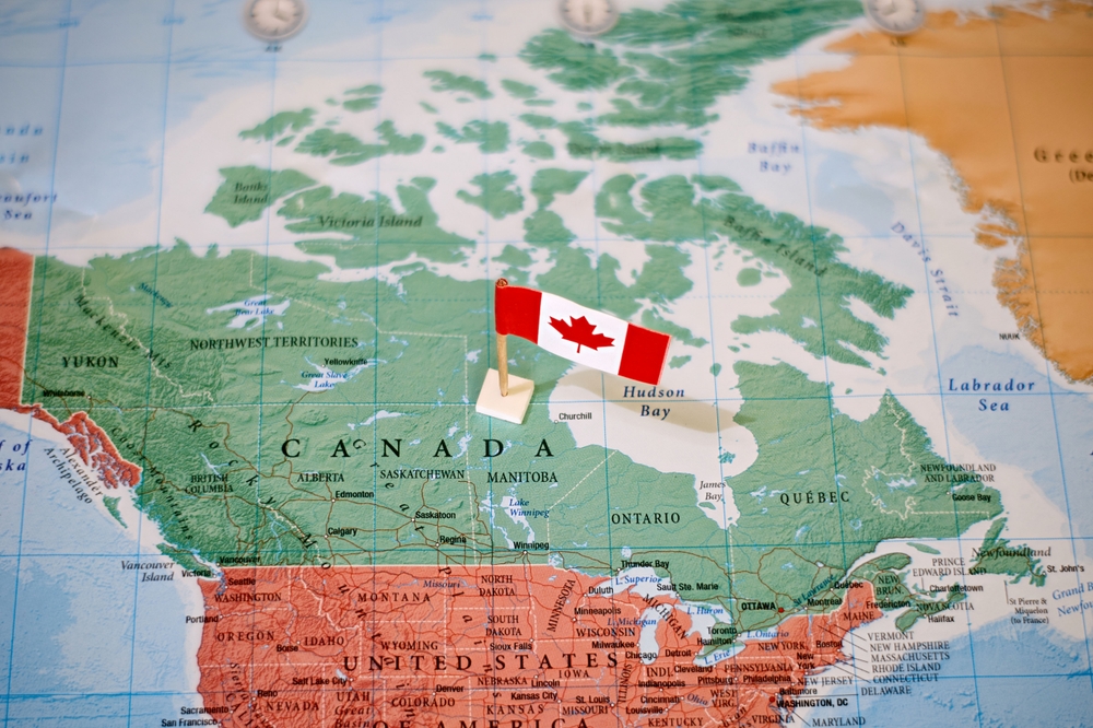
Why Did Canada Not Become Part of the United States?

Despite their shared geography, language, and historical connections, Canada and the United States developed as separate nations. Several key factors explain why Canada did not join the U.S.:

1. Loyalist Influence After the American Revolution

During the American Revolution (1775–1783), many colonists remained loyal to Britain. These Loyalists (including soldiers, officials, and civilians) fled to British-controlled territories in the north, strengthening their British identity. This deepened the divide between the new United States and what would become Canada.

2. The War of 1812

The U.S. attempted to invade British North America (now Canada) during the War of 1812, hoping to expand its territory. However, British troops, Canadian militias, and Indigenous allies successfully resisted American forces. This conflict reinforced a Canadian identity separate from the U.S. and increased loyalty to Britain.

3. Cultural and Political Differences

Canada remained under British rule longer and developed a government based on British parliamentary traditions. The U.S., in contrast, embraced a republican system with elected leaders and no ties to the monarchy. These differences created a distinct political and cultural identity for Canada.

4. Economic and Military Ties to Britain

Throughout the 19th century, Canada benefited from economic and military support from Britain. The British government invested in Canadian infrastructure, such as railways, and provided military protection. This support made merging with the U.S. less attractive.

5. Fear of American Expansionism

During the 19th century, the U.S. followed a policy of Manifest Destiny, seeking to expand westward. Many Canadians feared that joining the U.S. would mean being absorbed into an expansionist country that might not respect their existing rights and institutions.

6. The Formation of Canada (1867)

Instead of joining the U.S., the colonies of British North America united to form the Dominion of Canada in 1867 under the British North America Act. This move was partly to strengthen the region against potential U.S. expansion and to establish a self-governing nation under British influence.

Conclusion

Canada remained separate from the U.S. due to a combination of historical loyalty to Britain, military conflicts, cultural differences, economic ties, and concerns over American expansion. Instead of joining the U.S., Canada developed its own path, eventually becoming a fully independent country while maintaining ties to Britain.